
** Updated 2020 **
Location: Neranwood, Gold Coast QLD, Australia
Run Type: Trail (firetrail, hard-packed trail, rocky, steep climbing, forest, scenic, creek crossings)
Distance: 12.2km
Total Elevation Gain: 850m
GPS Link: Every Trail
Description:
A testing climb up to the summit, before a fast and furious descent. The only catch for this run is that it's out-and-back, meaning that fast and furious descent turns into a long climb on the return journey!
Directions are from the unsealed parking area opposite the track entrance on Gold Coast-Springbrook Rd. Look for the public toilet block next to the river.
From the parking area, cross the road and, staying on the roadside, head a short distance towards Springbrook until you see a Parks gate with a firetrail leading steeply uphill - this is your first indication of what's ahead of you! Step through the gate and begin to ascend the firetrail.
The trail is distinct and easy to follow, and for the next 2km you will be climbing steeply uphill for the most part. Do not follow any of the smaller off-shoot tracks (a number of these are marked with do not enter signs anyway). At the 1.6km mark you will come to a track junction, where you want to take the track to your right and heading uphill (the other option is straight-a-head-ish and looks flat from the junction point - this is shown on the map above).
At the 2km mark you will reach the "vomit log" (not my name for it!) at the summit of the climb. From here it is a steady descent (which is lots of fun!) to Pine Creek and beyond that to Pine Creek Rd. Trail choice again is easy: at each track junction you simply want to follow the most distinct route. Crossing Pine Creek can be tricky (if not impossible) after sustained rain periods, but otherwise it's not too difficult to pick a path across.
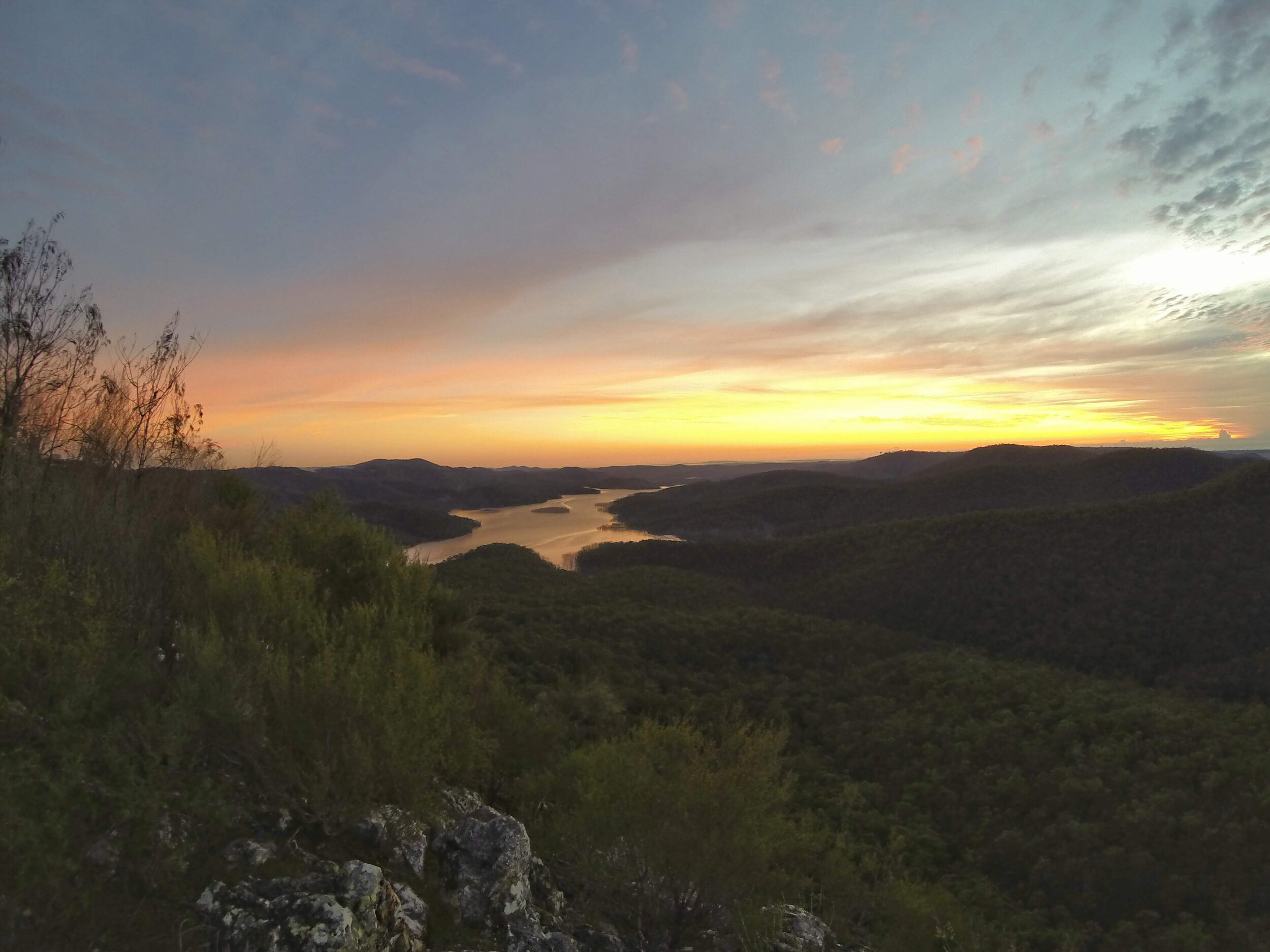
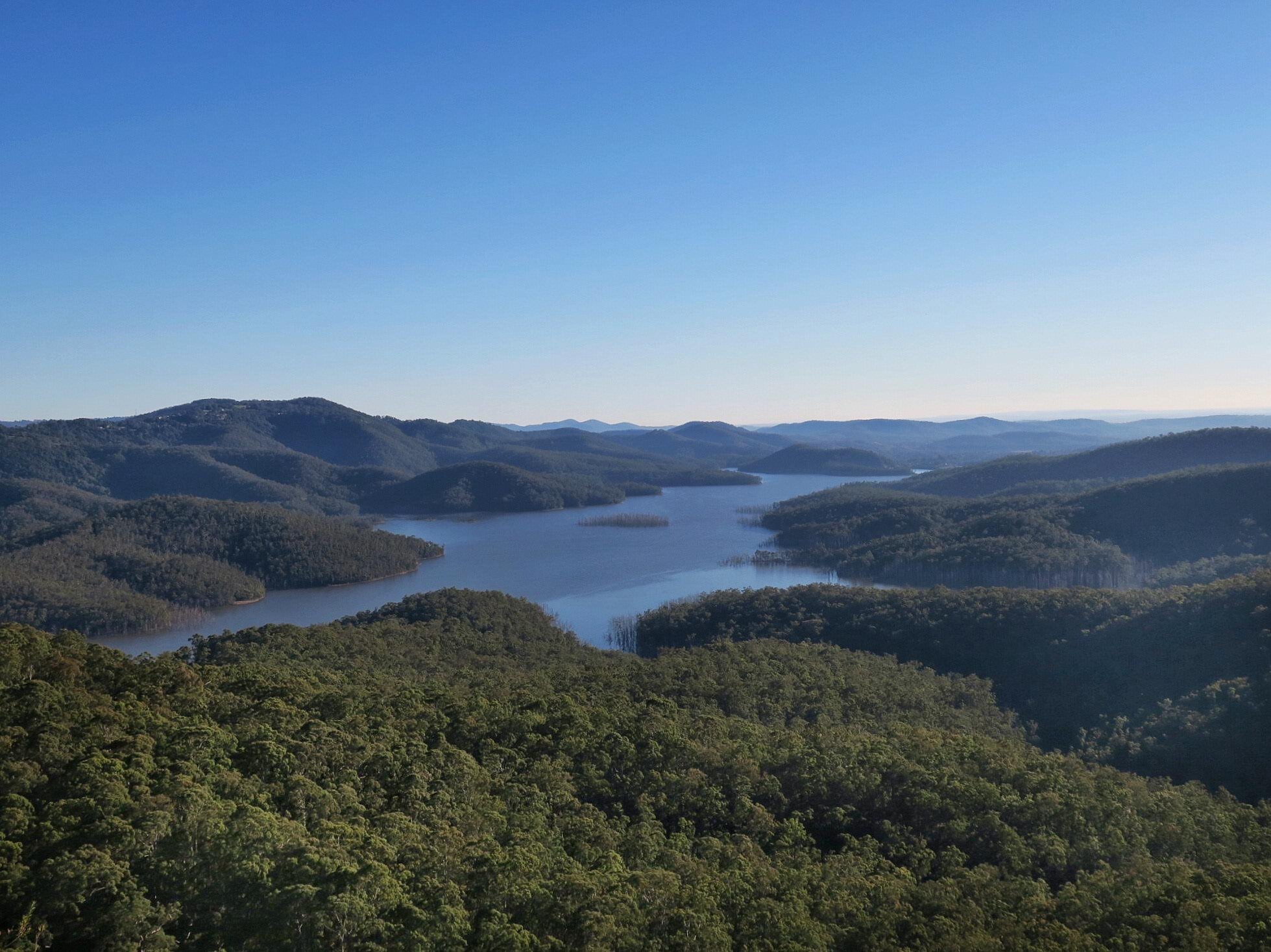
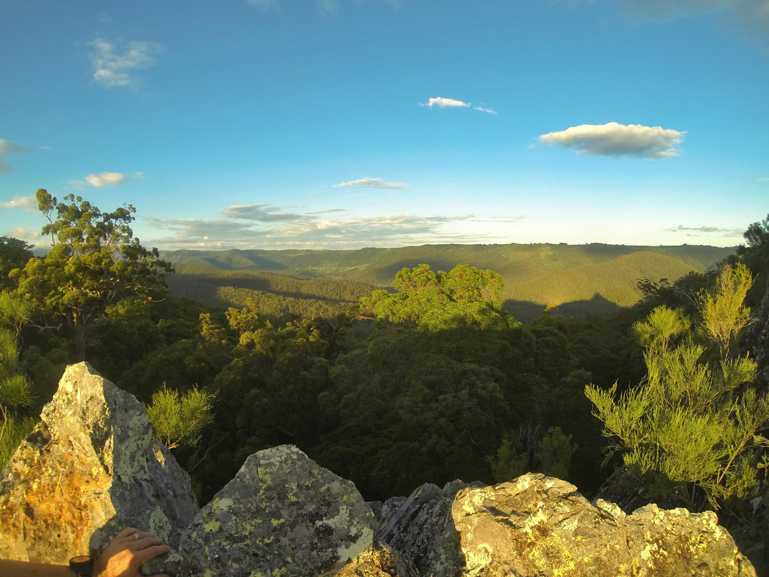
(NB - there is a footpad detour on the northern side off the descent - I’ll let you work out where - that goes out to Pages Pinnacle; a distinct outcrop that has spectacular views over Hinze Dam. Depending on your head for heights, there is a not-too-difficult (but exposed) scramble that eventually gets you to the head of the outcrop, and the views are worth the effort. The photos below are from this area.)
From Pine Creek it is a short, flattish jaunt to the gated entrance at Pine Creek Rd. The only decision to be made over this stretch of trail is at a 4-way track junction at which point you want to go left. Pine Creek Rd isn't much further along, so if you run for 5mins and don't hit it you've taken the wrong track.
The gate at Pine Creek Rd is the turnaround point for this run. When you turn around; take a breath, tighten your belt buckles and get ready to tackle the steady ascent ahead (you know, that long fun descent you just made!). Retrace your steps exactly as for the outward route all the way back up to the summit. From here, do what you need to at the vomit log and pick your way downhill back to the car.
This is obviously a run that involves some sustained climbing, but it's a great run for working on various aspects of your trail running as it has a great variety of terrain. Try and enjoy the views in between your gasps for air!
See you out there!